Published On Feb 7, 2021
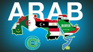
In this lesson, we examine the physical geography of the Middle East and North Africa. The lesson begins by defining the region including the Levant and the different countries that are included in this sub-reaching.
The lesson continues by examining the major bodies of water that surround the region. These include the Mediterranean Sea, Red Sea, Gulf of Aden, Arabian Sea, Gulf of Oman, and the Persian Gulf. We even take a peak at the Dead Sea.
Connecting these bodies of water are some critical chokepoints or straits which include the Strait of Gibraltar, Suez Canal, Bab el-Mandeb, and the Strait of Hormuz. We discuss how vital these narrow passages are and how conflict or piracy can impact the world due to the amount of trade that flows through them each day.
Then we discuss the climate and the region's deserts which include the Sahara, Arabian, Rub al-Khali, Syrian, and Negev Deserts.