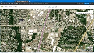
Download very high resolution satellite image 0.3 meter
Made 4 Geek
64.8K subscribers
331,606 views
2.7K
About
Share
Published On Oct 3, 2017
Download very high resolution satellite image cell size 0.30 m
show more
Share/Embed
Facebook
Twitter
Pinterest
LinkedIn
Video Link
Up next
8:54
Download SAS Planet | Software and height spatial resolution satellite images
Learn geomatics - EA
5.8K views • 7 months ago
13:21
OSINT At Home #9 – Top 4 Free Satellite Imagery Sources
Bendobrown
1.6M views • 3 years ago
6:45
🛑How to download High-resolution (0.3m) MAXAR satellite image for free, From OpenAreialMap & use GEE
Study Hacks-Institute of GIS & Remote Sensing
43K views • 1 year ago
8:45
Download high resolution (50cm) satellite images from soar | download and upload drone images
Data Analytics.m
35K views • 2 years ago
2:09
Download Very High Resolution Google Earth Pro Images Free
GIS Madras
91K views • 4 years ago
6:40
Updated Satellite Images Every 2-3 days.
Geo RGB
68K views • 3 years ago
4:02
Download high resolution satellite image using SASPlanet
Geocarto
11K views • 2 years ago
7:51
When deep learning meets satellite imagery
Preligens
123K views • 4 years ago
10:47
How to get the most current satellite imagery
sat103
176K views • 3 years ago
12:13
How to georeference maps in Google Earth
Made 4 Geek
35K views • 6 years ago
21:47
Download and georeference Google Earth images in QGIS 2.8 with OpenLayers Plugin
Monde Geospatial
245K views • 9 years ago
11:16
How to Download High-Resolution Satellite Images Using QGIS Plugin: A Comprehensive Guide
RS & GIS
32K views • 1 year ago
18:42
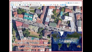
Download Very High Resolution Georeferenced Satellite Image
Geo-Spatial Tutorials
278K views • 8 years ago
10:03
How to download High-resolution (0.3m) MAXAR satellite image for free, From OpenAreialMap.
Geospatial Analysis
23K views • 2 years ago
9:50
How To Download Very High Quality Georeferenced Satellite Imagery From SAS Planet||Quick & Easy ||
Radhe Radhe
2.1K views • 7 months ago
19:12
Downloading Live Images from Satellites in Outer Space - GOES receiver
HackedExistence
20K views • 1 year ago
11:50
Historical high resolution satellite imagery (KH9) download | Declassified data | #part1 | GeoDev
GeoDev
2.6K views • 1 year ago
7:27
High Resolution Free Aerial Imagery in SketchUp
TutorialsUp
94K views • 6 years ago
8:06
Sentinel-2/How to Download 10m resolution sentinel -2 satellite image data
Ethio-GIS and RS channel(Abubeker D)
56 views • 11 days ago
12:05
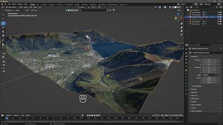
Videoguide - Import Terrain, BlenderGIS, Google Maps, Landscape, Buildings, Geographic Information
jbdtube
53K views • 1 year ago
Show More