Published On Sep 5, 2024
Here's how to make an ArcGIS Online imagery basemap with embossed streets and political boundaries. It's a cookie-cutter sort of thing where reference content, like the built environment and political borders, appear raised up off the surface. And they cast a little shadow because that's cute.
0:00 The riveting backstory
0:56 Setting up a basemap with water and labels
1:43 Speck the chicken interrupts the shoot
2:03 Pulling in the reference layer (streets, boundaries, etc)
2:30 Adding imagery, and applying the emboss trick
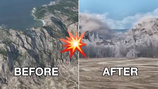
3:45 Before-after examples
4:33 Speck the chicken returns
Thanks for watching! Love, John Nelson
Check out some other social channels where I share how-to's and updates on random map adventures:
http://adventuresinmapping.com
https://www.esri.com/arcgis-blog/auth...
/ john_m_nelson
/ johnmnelson
/ johnmnelson
Music: Venkatesananda - Jesse Gallagher