Published On Aug 31, 2021
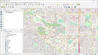
Dr. Sterling Quinn shows how to download an image, create a shapefile, and then trace (digitize) features from the image. This demo is performed in QGIS.
Central Washington University offers a GIS Certificate program and a Bachelor of Science degree in Geography with a GIScience specialization. For more information, visit https://www.cwu.edu/geography/
show more