Published On Nov 1, 2019
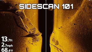
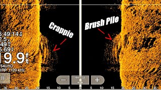
Side imaging is one of these most misunderstood aspects of fish finders among new bass fisherman. In this video, I break down exactly how to interpret the side imaging view on your graph. I also explain how to know where objects that appear on your screen are in relation to your boat. Hope you enjoy!
-Jonny
Fish Finder Recommendations (I’m not sponsored by any of these brands)
Beginner/Budget Fish Finder
Lowrance Hook2 7 Series Sonar TripleShot US/Can Nav+ (Side and Down Imaging)
https://www.tacklewarehouse.com/Lowra...
Intermediate Fish Finder
Lowrance Elite-9 Ti2 Fishfinder/Chartplotters
https://www.tacklewarehouse.com/Lowra...
Advanced/Expert Fish Finder
Lowrance HDS-12 Live Fishfinder/Chartplotters
https://www.tacklewarehouse.com/Lowra...
Book Fishing Lessons with Me!
Visit my website for Virtual and On-the-Water Fishing lessons, Map Breakdowns, Live Events, Merch and more!!
https://fishthemoment.com/
Support the Channel!
Join my Patreon using the link below to donate the channel and recommend ideas for my new videos!
/ fishthemoment
Use the Tackle Warehouse link below if you buy tackle online. I get a small share of the profits for all baits bought through this link!
https://www.tacklewarehouse.com/?from...
Links to Videos Mentioned
How to Graph Offshore Structure With a Fish Finder | Bass Fishing Sonar Basics
• How to Graph Offshore Structure With ...
How to Hit Offshore Structure First Cast Every Time! | Offshore Bass Fishing Tips
• How to Hit Offshore Structure First C...
Complete Guide to Bass Fishing Electronics | SideScan, DownScan, and 2D Sonar Explained
• Complete Guide to Bass Fishing Electr...
Music:
Tonez&Re-C - Kyoto by @TONEZPRO (OFFICIAL) / tonez-pro
Creative Commons — Attribution 3.0 Unported— CC BY 3.0
http://creativecommons.org/licenses/b...
Music provided by Audio Library • Video
Maps:
Google Earth
Navionics Web App: https://webapp.navionics.com
Genesis Social Maps: https://www.genesismaps.com/SocialMap
Follow me on:
Facebook: fishthemoment
Twitter: _FishtheMoment
Instagram: fishthemoment