Published On Dec 2, 2023
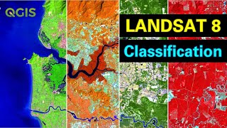
A Landsat 8 Image can be classified according to the corresponding land use in ArcGIS very easily.
In this video, Supervised Image Classification Process is explained in the simplest way.
#landsat #imageclassification #arcgis #imageclasses #supervisedclassification
_____________________________________________________________________
Channel Intro: • GIS (Geographic Information Systems) ...
NDMI: • NDMI in ArcGIS | Moisture Index Map i...
Area from Classified Image: • Area Calculation from Image in ArcGIS...
NDVI: • NDVI in ArcGIS | Vegetation Map in Ar...
BSI (Bare Soil Index) Calculation: • Stream Order Map from DEM in Model Bu...
Area and Perimeter in ArcGIS: • Calculate Area and Perimeter of Polyg...
Digitizing in Google Earth Pro: • Digitizing in Google Earth Pro in 5 M...
Zonal Statistics in ArcGIS: • ZONAL STATISTICS in ArcGIS
Interpolation in ArcGIS: • INTERPOLATION by KRIGING in ArcGIS | ...
Digitizing in ArcGIS: • Zero to Hero of Digitizing in ArcMap ...
Georeferencing for Beginners: • Georeferencing Downloaded Image (Map)...
Georeferencing from Google Earth Image: • Georeference and Project Image in Arc...
Playlist of Beginner Guide to GIS: http://bit.ly/48Y0Gxw
Subscribe to the Channel: / @geosciencelab
_____________________________________________________________________
This playlist on the applications of ArcMap (ArcGIS Software) will enrich your basic and practical knowledge on Geographic Information Systems (GIS).
_____________________________________________________________________
Free Asset: https://bit.ly/3N8KIr8
_____________________________________________________________________
I will sequentially upload videos on numerous ArcGIS applications so that you can master on Geospatial Analysis.
_____________________________________________________________________
Related Tags: image classification, landsat image classification, landsat 8 image, land use classification, image classification in arcmap, image analysis, image classify, landsat supervised classification, supervised classification in arcmap, how to do supervised classification in arcgis, how to do landsat 8 image classification, easy arcgis tutorial, arcgis attribute table, arc gis desktop, joining data to shapefile, arcgis raster, esri, arcgis topographic maps, GIS, Geographic Information System, Muhammad Al Amin, Geospatial Navigators