Published On Feb 6, 2024
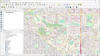
In this video, we'll use building footprints from OpenStreetMap, a DTM and a DSM to create 2D and 3D flood maps of a city. We'll start with preprocessing the data: interpolate voids in the DTM and extrude buildings, using the DSM and zonal statistics. Next, we'll prepare flood extent layers. Finally, we'll visualize the flood extent in 3D.
QGIS version: 3.34 Prizren
Open data: AHN, (c) OpenStreetMap contributors
Plugins: QuickOSM, PDOK Services, Qgis2threejs
0:00 Introduction
0:26 Download buildings from OpenStreetMap
1:58 Download DTM and DSM via PDOK Services plugin
4:35 Interpolate voids in DTM
6:18 Calculate slope
7:18 Extrude buildings
10:37 Prepare flood extent layer
12:56 3D visualization of flood extent
#QGIS #urban
show more