Layer Stack in QGIS [Sentinal-2, Landsat-5,6,7,8 & others 100% working] No Plugin required
GiS Station
2.54K subscribers
2,317 views
30
About
Share
Published On Jun 27, 2020
Layer Stack in QGIS [Sentinal-2, Landsat-5,6,7,8 & others 100% working] No Plugin required
show more
Share/Embed
Facebook
Twitter
Pinterest
LinkedIn
Video Link
Up next
6:48
QGIS Tutorials 49: Composite Bands / Layerstack in QGIS | Build Virtual Raster
Terra Spatial
6.7K views • 1 year ago
32:29
Supervised Image Classification | QGIS with Data Download, Stack, Process, band set, Crop and Swipe
GiS Station
972 views • 4 years ago
4:21
How I Conquered My Biggest Fears as a Game Developer!
Justin G
9 views • 42 minutes ago
13:03
Atmospheric Correction of Landsat image Using Semi Automatic Classification Plugin in QGIS
RS and GIS with Dr. Manoj
8.8K views • 3 years ago
12:43
Create Measurement Lines like AutoCAD in QGIS || Polygon Line Length Calculation
GiS Station
8.7K views • 3 years ago
13:52
Creating a Sentinel-2 Mosaic in QGIS using STAC and COG
Spatial Thoughts
4.9K views • 2 years ago
14:41
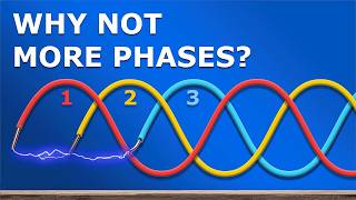
How 3 Phase Power works: why 3 phases?
The Engineering Mindset
1.1M views • 3 weeks ago
17:54
calculate LST,NDVI,NDBI,NDWI from landsat (5,4,7,8,9) { code}
Remote sensing &Almustafa Ayek
2.5K views • 1 year ago
22:56
Visualizing 4D Pt.1
HyperCubist Math
647K views • 1 month ago
8:52
Clip or Mask Raster using Polygon Layer in QGIS
GiS Station
8K views • 4 years ago
8:34
How to download the latest LANDSAT 9 image from USGS
RS and GIS with Dr. Manoj
4.2K views • 1 year ago
6:35
How to prepare Layer Stacking in QGIS or Merged File II লেয়ার স্ট্যাকিং কীভাবে প্রস্তুত করবেন
RS and GIS with Dr. Manoj
2.1K views • 3 years ago
10:18
I Replaced ALL my ADOBE APPS with these [free or cheaper] Alternatives!
Joris Hermans
645K views • 1 month ago
6:29
Polygon to Raster (Rasterize) with QGIS
Hydro-Morphodynamics
12K views • 3 years ago
26:18
18 Weird and Wonderful ways I use Docker
NetworkChuck
144K views • 1 day ago
16:26
Tutorial: Determination of Glaciers and Lakes from Sentinel 2 Images with QGIS and SCP Plugin
Hatari Labs
4.2K views • Streamed 6 years ago
19:55
Supervised Classification in QGIS | Landuse Landcover Map in QGIS | SCP tool
Dawn Of Geospatial World
3.2K views • 4 months ago
15:31
Dynamic Area & Periphery Calculation in QGIS || Calculate Polygon Area Dynamically ||
GiS Station
3.1K views • 3 years ago
9:12
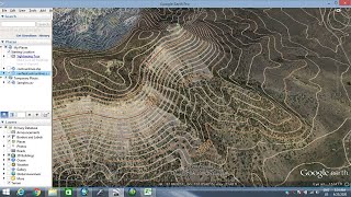
How to extract contour lines And DEM from Google Earth
Made 4 Geek
876K views • 4 years ago
19:42
Space-Time: The Biggest Problem in Physics
Quanta Magazine
99K views • 1 day ago
Show More