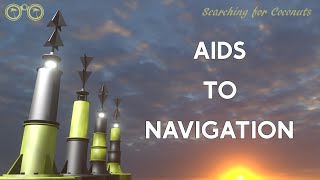
Published On Jun 29, 2017
Buoyage video explanation looked at with a how to "Captain" or "Navigator" perspective - to give a practical understanding. In the middle of a stormy night - when a buoy flashes, you need to know instinctively, what to do.
Buoy Chapters
0:00 Introduction to marine buoys and markers
0:49 IALA regions (B) USA and (A) Rest of world)
2:01 Safe water - safe navigation all around the buoy
2:37 Isolated danger - small areas of danger in immediate vicinity
3:33 Lateral - marking the sides or port and starboard limits of navigation channels
4:40 Special - other areas where various activities are / are not allowed - military / swimming / jetski / private palaces
5:18 Cardinal buoys - indicating safe direction of navigation ie which direction is safe to be in (opposite indicating the danger)
6:28 North Cardinal (stay North of the buoy)
6:52 East Cardinal (stay East of the buoy)
7:19 South Cardinal (stay South of the buoy)
7:59 West Cardinal (stay West of the buoy)
8:22 Emergency Wreck Marker - wrecks - submerged or partially submerged ships wrecks and danger to other vessels
9:08 More info on the website www.coastalsafety.com
If you remember the 10 types of buoy - then it is easy to remember.
Especially when you group the buoys together
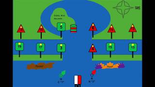
1 &2) LATERAL CHANNEL - marking channels (PORT & STARBOARD)
3, 4, 5 & 6) CARDINAL - indicating safe direction of navigation (North East South West)
7) ISOLATED DANGER (NO - do not come here) - danger in the immediate vicinity of the buoy
8) SAFE WATER (YES it's OK to come close)- safe navigation all around the buoy
9) EMERGENCY WRECK (do not approach) - submerged and partially submerged ships wrecks and danger
10) SPECIAL (only approach if you know what is there)- other areas where various activities are / are not allowed
These are simple ways that we teach the basic foundations ... from which we build greater knowledge.
Subtitles available in Arabic, English, French, Hindi, Sinhala, Tagalog
(Red or Green - Port or Starboard) - (Americas or rest of the world)
Region A covers Europe and most of the of the world (red to port side).
Region B covers the America, Japan, the Philippines and South Korea (Green to port side).
Flash - less light & more darkness
Long flash - longer flash but still less light & more darkness
Isophase - equal time of light and darkness
Occulting - more light & less darkness
LATERAL CHANNEL marks are used generally to mark the sides of well-defined, navigable channels.
They are positioned in accordance with the "Conventional Direction of Buoyage" as discussed above. Port and Starboard lateral marks tend to be can shaped on the port side and conical shaped on the starboard side - this makes them easier to identify in low light or reduced visibility conditions.
CARDINAL buoys and marks warn of danger and remain constant throughout the system of two IALA regions. There may be only one buoy or more depending on the danger and the shape of the coast. For example, close to the shore they may be only one buoy as it may not be possible to go between the wreck and the shore. The buoys have two black cones in different configurations which are know as the "top mark" cones - these point to the black areas on the body of the buoy - the rest of the buoy is yellow.
The body of a cardinal buoy is always marked with a combination of black and yellow bands. It is always surmounted with a topmark consisting of 2 black triangles arranged in 1 of 4 combinations.
Cardinal Marks are used in conjunction with the compass to indicate the direction from the mark in which the deepest navigable water lies, to draw attention to a bend, junction or fork in a channel, or to mark the end of a shoal.
The buoys indicate where the safe water is:
North of a North mark
South of a South mark
East of an East mark
West of a West mark.
ISOLATED DANGER Marks are used to mark small, isolated dangers with navigable water around the buoy. They are used to mark an isolated hazard in waters which otherwise are navigable. The pattern of bands is BLACK over RED over BLACK. The topmark is 2 BLACK balls. If lit, the light will show 2 WHITE flashes (Fl 2).
They can mark:
- a small area of rocks
- a pinnacle rock
- small sand bank
- old collapsed buildings in the sea
- pipes that are a danger to surface navigation
SAFE WATER marks may be used at the seaward end of the start of a channel to a port, mid-channel, as a centreline markers or at the point where land is reached.
These buoys (as the name suggests) indicate the presence of safe, navigable water all around the buoy.
EMERGENCY WRECK Buoys provide a clear and unambiguous means of marking new wrecks.
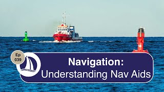
Watch the full video with explanations and "Top Tips"
• Understanding Marine Buoyage - full v...