Published On Feb 13, 2021
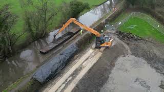
Using Google Earth satellite imagery, we follow the proposed alignment of the ongoing restoration of the Ashby-de-la-Zouch Canal, from the current limit of navigation at Snarestone Wharf, to the new northern terminus at Bath Yard Basin, to the north of Moira.
The proposed and existing restored sections are shown in cyan, the original alignment is shown in blue, and intersecting railways (past, present and future) are shown in yellow. Labels reflect the present day surroundings, where industry has given way to conservaion and leisure. A second video, following the original route, reflects the industrial context of the canal.
show more