Published On Aug 5, 2021
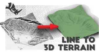
In this video, I explain how to use a grayscale image to derive the height values of a terrain, and reconstruct a 3D model of the terrain with color and isoheight curves.
📝Course playlist: • Introduction to Parametric Modeling
💻Code: https://github.com/ParametricCamp/Tut...
Join us:
💬 / discord
📺 / parametriccamp
📷 / parametriccamp
🐦 / parametriccamp
💻https://github.com/ParametricCamp
📷🕺 / garciadelcastillo
🐦🕺 / garciadelcast
show more