Published On Jul 24, 2021
Convert points to a polygon with ArcGIS without digitizing
if you enjoy this tutorial, please help to subscribe.
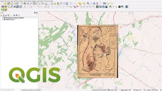
You can extract data from OpenStreetMap as Vector (Shapefile) by using QuickOSM plus in with QGIS. You can see the other lessons in QGIS in list below, please don't forget subscribe to my channel and leave your comment below if you wish to see more videos.
#conten of tutorials Below:
1. How to install QGIS: • QGIS 1: Downloand and Install QGIS 3.10
2. Download QGIS for free of charge: https://qgis.org/en/site/forusers/dow...
3. How to download data for QGIS : • how to download data for QGIS
4. Download Data QGISData: https://www.dropbox.com/h?preview=QGI...
5. Lesson 1: QGIS Elearning: • QGIS E-learning
6.Lesson 2: Order layers and make a nice road with QGIS: • QGIS 2: Order layers and make a nice ...
7. Lesson 3: Order Layers and Label: • QGIS E-learning: Order layers and labels
8. Lesson 4: How to make label with line layers: • QGIS 4: How to make label with line l...
9. Lesson 5:Map Layout (Legend, North Arrow, Scale, data frame and coordination): • QGIS 5: Map Layout (Legend, North Arr...
10. Extract data from OpenStreetMap as Vector (Shapefile): • QGIS 10: Extract data from OpenStreet...
#List of tutorials Below:
1. Lesson 1: QGIS Elearning: • QGIS E-learning
2. Lesson 2: Order layers and make a nice road with QGIS: • QGIS 2: Order layers and make a nice ...
3. Lesson 3: Order Layers and Label: • QGIS E-learning: Order layers and labels
4. Lesson 4: How to make label with line layers: • QGIS 4: How to make label with line l...
5. Lesson 5:Map Layout (Legend, North Arrow, Scale, data frame and coordination): • QGIS 5: Map Layout (Legend, North Arr...
6. Lesson 6. how to edit legend and coordination: • QGIS 6: How to edit legend and coordi...
7. Lesson 7: How to add UTM to QGIS: https://www.youtube.com/watch/tsQuh...
8. Lesson 8: How to convert Point to polygon with QGIS៖ • QGIS 8: How to convert Point to polyg...
9. Lesson 9: How to covert Point to Polygon, and edit shapefile: • QGIS 9: How to covert Point to Polygo...
10. Lesson 10: Add and delete fields in attitude table in QGIS: • QGIS 10: Add and delete fields in att...
11. Lesson 11: How to calculate XY with QGIS: • QGIS 11: How to Calculate XY in QGIS
12. Lesson 12: How to calculate area in QGIS: • QGIS 12: How to calculate area in QGIS
13. Lesson 13: How to select feature base on attitude table and clip tool: • QGIS 13: How to select feature base o...
14. How to add google Earth and Google map to QGIS: • QGIS 14: How to add google Earth and ...
15. Convert Point to Polygon with QGIS: • QGIS 8: Convert Points to a Polygon w...
16.Convert point to polygon with ArcGIS: • Convert points to a polygon with ArcGIS
17. Digitize Google Map and Spatial Area Calculation: • QGIS 17: Digitize Google Map and Spat...
18. QGIS Tutorial: Calculate area based on Categories with QGIS: • QGIS 18: Calculate area based on Cate...